|

 Save time and money by using our booking service.
more details
|
| |
| |

|
 |

We charge a nominal fee for proprietors to be included in our directory. This ensures that people who promote their accommodation with us actively welcome and specifically cater for the needs of walkers. The accommodation details contained within the guide are constantly updated.
Last Updated:
26th April 2024
|
|
 |
 |
|

|
|


|
|
|
|
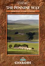
National Trail: Guide to Walking the Pennine Way
|
by Paddy Dillon
Published:
29 Mar 2010
Binding: Paperback - PVC, 224 Pages
Dimensions: 172 mm x 116 mm
Weight:
310 grams
|
RRP:
�12.95

|
| |
 An essential guide for those planning to walk The Pennine Way National Trail, from Edale in Derbyshire to Kirk Yetholm, on the Scottish border. The first long-distance path in Britain, in 1965, it traverses the 'backbone of England', striving to stay high on the moors, yet dropping down to delightful towns and villages for the night.
Seasons
- This National Trail is essentially a summer walk, though it can be completed in spring or autumn, the winter months are solely for dedicated and experienced long-distance walkers.
Centres
- Edale, Crowden, Hebden Bridge, Cowling, Gargrave, Malham, Horton in Ribblesdale, Hawes, Keld, Bowes, Middleton-in-Teesdale, Dufton, Alston, Hadrian�s Wall, Bellingham, Byrness, Kirk Yetholm
Difficulty
- The Pennine Way is a challenging walk, often across high, exposed moorlands. No problems on fine, sunny days, but some parts can be exceptionally difficult in bad weather. In mist, careful navigation is required, but on the whole the route is well-signposted. Suitable for backpackers and youth hostellers, but ample B&B accommodation is also available. Previous long-distance walking experience is an advantage.
Must See
- Peak District National Park � Kinder Scout, Bleaklow and Black Hill; South Pennines � Stoodley Pike and Bront� Country; Yorkshire Dales National Park � Malham Cove, Pen-y-Ghent and Great Shunner Fell; North Pennines AONB � Teesdale, High Cup and Cross Fell; Northumberland National Park � Hadrian�s Wall and the Cheviot Hills.
Back to the Books Page |
to top of the Page
|
|


