


|
|
|
|
[
] [
]
The Pennine Way takes you to some of the highest and most remote moorland in England, where the weather can be severe. It will be best if you supplement your guide book with one of the maps available in our Bookshop. We offer a choice that will help keep you on course.
|
| |
Ordnance Survey Explorer Maps

|
|
Scale 1:25,000; 4cm to 1km; 2� inches to 1 mile
The Pennine Way is covered by nine Ordnance Survey Explorer maps, scaled 1:25,000. They are sheets OL1, OL21, OL2, OL30, OL31, OL43, OL42, OL16 and OL19. The maps are printed both sides, and this scale allows you to navigate in great detail; walls and hedges are shown, for example. The route is marked in Green Diamonds throughout.
These maps are available in two editions:
Paper - they fold well, and are backed with a reasonably durable laminated cover. They will remain intact, depending on how much wind and rain you have encountered!
Lam-Fold - extra strong lamination with a 'china-graph' write-on, wipe-off surface they are also tear resistant and waterproof.
|
| |
| |
|
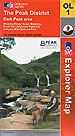
Map OL1: The Peak District
|
click to enlarge
|
1:25,000; 2.5 inches to 1 mile; 4cm to 1km
Dimensions: 225 mm x 135 mm
|

|
|
|
|
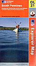
Map OL21: South Pennines
|
click to enlarge
|
1:25,000; 2.5 inches to 1 mile; 4cm to 1km
Dimensions: 225 mm x 135 mm
|
|
|
|
|
|
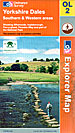
Map OL2: Yorkshire Dales. Southern & Western areas
|
click to enlarge
|
1:25,000; 2.5 inches to 1 mile; 4cm to 1km
Dimensions: 225 mm x 135 mm
|
|
|
|
|
|
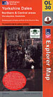
Map OL30: Yorkshire Dales. Northern & Central areas
|
click to enlarge
|
1:25,000; 2.5 inches to 1 mile; 4cm to 1km
Dimensions: 225 mm x 135 mm
|
|
|
|
|
|
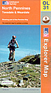
Map OL31: North Pennines. Teesdale & Weardale
|
click to enlarge
|
1:25,000; 2.5 inches to 1 mile; 4cm to 1km
Dimensions: 225 mm x 135 mm
|
|
|
|
|
|
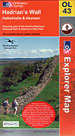
Map OL43: Hadrians Wall. Haltwhistle & Hexham
|
click to enlarge
|
1:25,000; 2.5 inches to 1 mile; 4cm to 1km
Dimensions: 225 mm x 135 mm
|
|
|
|
|
|
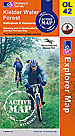
Map OL42: Kielder Water. Bellingham & Simonside Hills
|
click to enlarge
|
1:25,000; 2.5 inches to 1 mile; 4cm to 1km
Dimensions: 225 mm x 135 mm
|
|
|
|
|
|
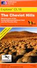
Map OL16: The Cheviot Hills
|
click to enlarge
|
1:25,000; 2.5 inches to 1 mile; 4cm to 1km
Dimensions: 225 mm x 135 mm
|
|
|
|
|
|
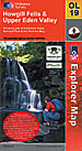
Map OL19: Howgill Fells & Upper Eden Valley
|
click to enlarge
|
1:25,000; 2.5 inches to 1 mile; 4cm to 1km
Dimensions: 225 mm x 135 mm
|
|
|
|
|
| |
|
Ordnance Survey Landranger Maps
|
|
Scale 1:50,000; 2cm to 1km; 1� inches to 1 mile
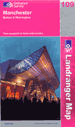
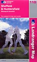
If you use the 1:50,000 Ordnance Survey Landranger maps you will nine maps; sheets 80; 86; 92; 91; 98; 103; 109; 110; 74.
1;50,000 is a good practical scale. The Pennine Way is marked and the detail is sufficient for most situations along this walk. This scale allows you a wide perspective, too, and this is especially useful for the many and varied viewpoints this walk offers.
|
| |
|
These maps are available in two editions:
Paper - they fold well, and are backed with a reasonably durable laminated cover. They will remain intact, depending on how much wind and rain you have encountered!
Lam-Fold - extra strong lamination with a 'china-graph' write-on, wipe-off surface they are also tear resistant and waterproof. They are however, a little bulkier than the 'wilderness' version.
|
| |
| |
|
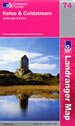
Map 74: Kelso & Coldstream
|
click to enlarge
|
1:50,000; 2cm to 1km; 1.25 inches to 1 mile
Dimensions: 225 mm x 135 mm
|
|
|
|
|
|
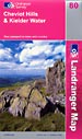
Map 80: Cheviot Hills & Kielder Forest area
|
click to enlarge
|
1:50,000; 2cm to 1km; 1.25 inches to 1 mile
Dimensions: 225 mm x 135 mm
|
|
|
|
|
|
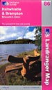
Map 86: Haltwhistle & Brampton
|
click to enlarge
|
1:50,000; 2cm to 1km; 1.25 inches to 1 mile
Dimensions: 225 mm x 135 mm
|
|
|
|
|
|
Map 92: Barnard Castle & area
|
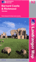
click to enlarge
|
1:50,000; 2cm to 1km; 1.25 inches to 1 mile
Dimensions: 225 mm x 135 mm
|
|
|
|
|
|
Map 91: Appleby-in-Westmoreland area
|
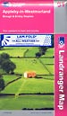
click to enlarge
|
1:50,000; 2cm to 1km; 1.25 inches to 1 mile
Dimensions: 225 mm x 135 mm
|
|
|
|
|
|
Map 98: Wensleydale & Upper Wharfedale
|
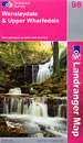
click to enlarge
|
1:50,000; 2cm to 1km; 1.25 inches to 1 mile
Dimensions: 225 mm x 135 mm
|
|
|
|
|
|
Map 103: Blackburn & Burnley
|
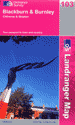
click to enlarge
|
1:50,000; 2cm to 1km; 1.25 inches to 1 mile
Dimensions: 225 mm x 135 mm
|
|
|
|
|
|
Map 109: Manchester, Bolton & Warrington
|
click to enlarge
|
1:50,000; 2cm to 1km; 1.25 inches to 1 mile
Dimensions: 225 mm x 135 mm
|
|
|
|
|
|
Map 110: Sheffield & Huddersfield
|
click to enlarge
|
1:50,000; 2cm to 1km; 1.25 inches to 1 mile
Dimensions: 225 mm x 135 mm
|
|
|
|
|
|
ThePennineWay Suggestions
|
|
|
The 1:50,000 maps are single-sided and easy to handle. The 1:25,000 maps are double-sided and this can occasionally be irritating.
The Pennine Way is Britain's most famous National Trail and is well walked and signposted. As such 1:50,000 maps should be sufficient in good weather. But the Pennine Way follows the backbone of England where you are inevitably going to experience bad weather and poor visibility throughout some of your walk. This is when 1:25,000 maps are better.
|
|
|
| |